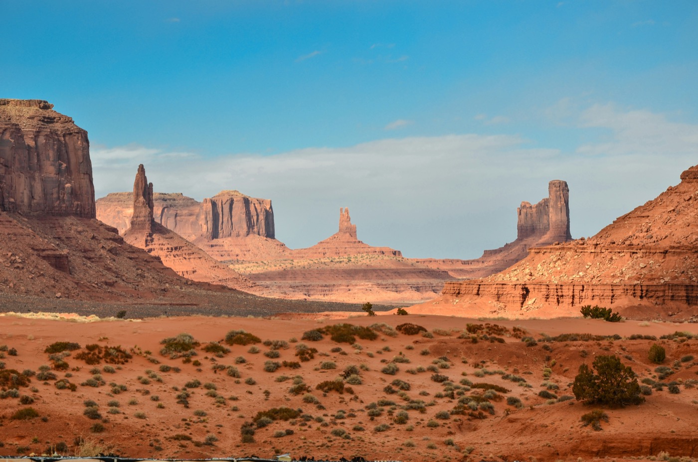
The USA’s road network is extraordinary in scale - over 4 million miles of roads including some of the world’s most legendary drives. Knowing which states deliver the best return for a week or two behind the wheel helps you plan a trip that actually matches the postcards.
These are five states where the driving itself is as good as the destinations.
1. California
Best for: Coastal scenery, wine country, national parks, urban variety
California has an embarrassment of road trip riches. Highway 1 - the Pacific Coast Highway - threads along dramatic sea cliffs from San Francisco south through Big Sur to Los Angeles. The full drive is around 650 miles; most travellers spend five to seven days to do it justice.
Inland, the Sierra Nevada opens up a different world. Yosemite Valley is accessible from the west year-round; Tioga Pass (Highway 120, elevation 9,945 ft) crosses the range but closes in winter, typically from November to May. Death Valley in the southeast is best visited November through March - summer temperatures exceed 120°F (49°C) and driving with inadequate water is genuinely dangerous.
Named routes to plan:
- Highway 1, Carmel to Malibu - the Big Sur stretch. Allow 3–4 hours minimum for the 150-mile section; there are no shortcuts and landslides occasionally close short sections. Fuel up in Carmel or San Simeon - there are no gas stations on Highway 1 between these towns.
- Highway 395, Bishop to Lone Pine - the eastern Sierra Nevada backdoor. Fewer crowds than the Yosemite approach, dramatic volcanic landscapes, the Alabama Hills near Lone Pine (used in countless Western films).
- Napa and Sonoma Valley loop - from San Francisco, Route 29 north through Napa, then Highway 12 west to Sonoma. Day trip or overnight.
Car rental notes: San Francisco and Los Angeles airports are the main gateways. Off-airport locations in downtown San Francisco and in Santa Monica save 15–25% versus SFO or LAX airport counters. FasTrak handles Bay Area bridge tolls ($7 for the Bay Bridge); most Highway 1 driving has no tolls.
Approximate drive time: San Francisco to Los Angeles via Highway 1 - 10–12 hours of driving time over 4–6 days at a proper pace.
2. Utah
Best for: Red rock canyon country, five national parks, stargazing, dramatic geology
Utah’s “Mighty Five” national parks form a natural road trip loop that has no equivalent in the world. The state is compact enough that all five parks fit into a 250-mile north-to-south corridor, yet each one looks unlike any other.
The Mighty Five loop (approximately 7–10 days):
| Park | Key Feature | Entry Fee (2026) |
|---|---|---|
| Zion | Angel’s Landing, The Narrows (slot canyon hike) | $35/vehicle |
| Bryce Canyon | Hoodoo rock formations at dawn | $35/vehicle |
| Capitol Reef | Waterpocket Fold, less crowded than Zion | $20/vehicle |
| Arches | Delicate Arch, over 2,000 natural arches | $35/vehicle |
| Canyonlands | Island in the Sky district, White Rim Road | $35/vehicle |
The America the Beautiful Annual Pass ($80/vehicle, available at any park entrance or online) covers all national park entry fees and pays for itself after three parks.
Utah Highway 12 between Bryce Canyon and Capitol Reef is one of the most scenic drives in North America - winding over ridgelines with canyon views dropping hundreds of feet on both sides. Allow a full day for the 124-mile route; there are designated scenic pull-outs every few miles.
Car rental notes: Fly into Las Vegas (closest major airport to Zion) or Salt Lake City (closest to Bryce/Arches). A mid-size AWD SUV is recommended - Monument Valley and some access roads involve washboard dirt surfaces that damage standard saloon car suspension. No toll roads in Utah.
Best season: Spring (April–May) and autumn (September–October). Summer brings extreme heat in canyon bottoms (100°F+) and large crowds at Zion, which now requires a shuttle bus - you cannot drive private vehicles to most trailheads.
3. Montana
Best for: Wild landscapes, Glacier National Park, wide-open highways, wildlife
Montana has the lowest population density of any contiguous US state. On the highways east of the Rockies - two-lane roads through grassland - you can drive for an hour without seeing another car. This is the version of the American West that exists before it gets visited.
Glacier National Park is the centrepiece. The Going-to-the-Sun Road - 50 miles across the Continental Divide - is one of the engineering marvels of the US road network and one of the most dramatic mountain drives anywhere. The road is only fully open from roughly late June to mid-October (snow determines exact dates each year). Vehicles over 21 feet or 8 feet wide cannot drive the full road - check restrictions if renting a large vehicle.
Vehicle reservations or timed entry permits are required to drive Going-to-the-Sun Road during peak season (typically 6am–3pm). Book through recreation.gov well in advance - slots sell out weeks ahead.
Other Montana drives:
- US-2 along the Hi-Line - the northern edge of the state, tracing the Canadian border. Far from scenic in a dramatic sense, but hauntingly empty and genuinely frontier.
- Highway 200 through the Blackfoot Valley - Norman Maclean territory. Fly-fishing rivers, October aspen colour.
- Chief Joseph Scenic Highway (shared with Wyoming) - approaching Yellowstone from the northeast through the Beartooth Mountains.
Car rental notes: Fly into Missoula (west side of Glacier) or Great Falls / Billings (east side access). Rental options are more limited than in California or Utah - book early, especially for summer. No tolls in Montana.
Best season: July–September for Going-to-the-Sun Road. October for fall foliage in valleys. Winter driving requires snow tyres or chains on mountain passes.
4. Oregon
Best for: Pacific coast, old-growth forest, volcanic landscapes, less crowded than California
Oregon’s Highway 101 offers a Pacific Coast drive with fewer tourist crowds than California’s Highway 1. The coastline is publicly accessible - all Oregon beaches are public by state law - and small coastal towns (Cannon Beach, Newport, Bandon) have genuine character.
Inland, the Cascade Range offers a completely different trip. Crater Lake - the deepest lake in the USA, formed in the caldera of a collapsed volcano - sits on the Rim Drive, a 33-mile loop with views down into the improbably blue water.
Named routes:
- US-101, Astoria to Brookings - the full Oregon coast, roughly 360 miles. Allow 4–5 days at a comfortable pace. Stop at Cape Perpetua, the Sea Lion Caves, and the Oregon Dunes.
- McKenzie Pass Highway (OR-242) - between Sisters and McKenzie Bridge. Crosses lava fields from the last eruption in this region (around 1,600 years ago). Closed November–June due to snow.
- Cascade Lakes Scenic Byway - out of Bend, looping through Deschutes National Forest past a series of alpine lakes. Good for a day trip with a kayak or fishing gear.
Car rental notes: Portland is the main gateway (PDX airport). Eugene is convenient for the central coast and Crater Lake. Off-airport Enterprise and Hertz locations in downtown Portland are typically 20% cheaper than PDX. No toll roads in Oregon outside of one bridge crossing on the Washington border.
Best season: July–October. The coast is cool and sometimes foggy in summer (highs of 60–65°F / 15–18°C) - pack layers regardless of season.
5. Texas
Best for: Big Bend, the Hill Country, epic distances, barbecue culture
Texas is large enough to require a different approach to road trips - you pick a region rather than trying to cross the state. The distances between major attractions in west Texas are significant: Austin to Big Bend National Park is 7 hours of driving.
Big Bend National Park is the least visited of the major national parks and arguably the most otherworldly. The Rio Grande carves canyon walls on the US-Mexico border, and the Chisos Mountains rise unexpectedly from the desert floor. The drive in - either via US-90 from Alpine or FM-170 from Presidio - is itself part of the experience.
The Texas Hill Country - the region west of Austin centred on Fredericksburg and Kerrville - offers a more accessible road trip. Rolling limestone hills, spring wildflowers (bluebonnets peak late March to mid-April), and a dense concentration of wineries, German-heritage towns, and small restaurants along US-290 and TX-16.
Named routes:
- The Lonesome Highway (US-90) - Marathon to Del Rio. The emptiest stretch of highway in the lower 48, roughly 170 miles through Chihuahuan Desert with almost no services. Keep the fuel tank above half.
- FM-170 (River Road) - from Presidio to Big Bend along the Rio Grande. One of the most dramatic desert drives in the country; 60 miles with no services.
- US-290, Fredericksburg to Austin - the Hill Country wine trail. Dozens of family wineries, peach orchards (June–July), and the towns of Stonewall and Johnson City.
Car rental notes: Fly into Austin or San Antonio for Hill Country. For Big Bend, the nearest airport with good rental availability is Midland/Odessa (3.5 hours from the park). TxTag handles Houston and Dallas toll roads. No tolls in west Texas. A full-size sedan is adequate for all roads listed - four-wheel drive is not required unless you plan to drive dirt roads within Big Bend itself.
Best season: October–April. Texas summer heat in west Texas (105°F+/40°C+) makes hiking and outdoor activity difficult. Spring wildflower season (late March–April) is the most popular time for Hill Country.
Planning Your Car Rental
For any of these road trips, compare rental rates across multiple platforms before booking. GetRentaCar aggregates prices from all major companies with full fee breakdowns - the headline rate and the total after surcharges can differ significantly at US airport locations.
Book a refundable rate where possible - prices fluctuate and re-booking at a lower rate is common for flexible travellers.
Related Guides
- Renting a Car in the USA: Complete Guide for International Visitors
- Route 66 Road Trip Guide
- National Parks of the USA
- USA Itineraries
Plan Your Trip
✈️ Book your flights to the USA 🛡️ Get travel insurance 📱 Stay connected with an eSIM 🚗 Compare car rental prices