Moab sits in the heart of the Colorado Plateau - a landscape of slickrock, sandstone fins, and river canyons that concentrated two national parks, two state parks, and a river that carved the American Southwest into the same tight radius around a town of 5,000. Day trips here are mostly a question of which park or canyon to prioritize: everything worth seeing is within 90 minutes, much of it within 30, and the quality of each destination is genuinely world-class. Guided jeep and off-road tours from Moab also access terrain that requires 4WD - browse Moab tours and activities for jeep, UTV, and Colorado River options.
Arches National Park - 5 minutes north
Arches National Park contains more natural sandstone arches than anywhere else on Earth - over 2,000 catalogued spans in 76,518 acres. The park entrance is five miles north of Moab on US-191, making it the most accessible major park in the region.
Entry: Approximately $35 per vehicle as of 2026, valid for seven days. Timed entry reservations are required April through October, bookable at recreation.gov from approximately $2 as of 2026 - book weeks ahead for spring and fall visits.
Key sights: Landscape Arch (a two-mile round-trip walk from Devils Garden) is the longest natural arch in North America at 290 feet span. Delicate Arch (3 miles round-trip, 480-foot elevation gain) is the park’s icon - the hike is best done at sunset or early morning in summer to avoid midday heat. The Windows Section (short loops, 0.5–1 mile) is accessible to all fitness levels.
Drive from Moab: US-191 north, 5 miles, under 10 minutes to the entrance.
Canyonlands National Park - 30 minutes northwest
Canyonlands is Utah’s largest national park and arguably its most dramatic - the Colorado and Green Rivers have carved a thousand-foot-deep canyon system into the plateau, visible from the Island in the Sky district’s 6,000-foot mesa rim. The sense of scale here exceeds Arches in every dimension.
Entry: Approximately $35 per vehicle as of 2026, valid for seven days. No timed entry system as of 2026.
Island in the Sky district: Mesa Arch (0.5 miles round-trip, free to walk, no additional fee) at sunrise is one of the most photographed views in the Southwest - a natural window framing the canyon in morning light. Grand View Point Overlook (0.2 miles, paved) covers 100 miles of canyonland. Upheaval Dome Crater (0.8 miles to first overlook) is either a meteorite impact or salt dome collapse - geologists still disagree.
Drive from Moab: US-191 north then HI-313 west, about 35 miles, 35 minutes to the Island in the Sky visitor center.
Dead Horse Point State Park - 35 minutes northwest
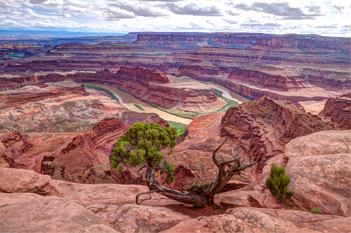
Dead Horse Point sits on a promontory 2,000 feet above the Colorado River with views that photographers consistently rate equal to or better than the overlooks in neighboring Canyonlands. The Colorado makes a dramatic 180-degree meander visible from the main overlook - the river’s entrenched canyon in turquoise and orange cuts through the plateau to the horizon.
Entry: Approximately $20 per vehicle as of 2026. Reservations required for camping; day use is generally available without advance booking. The visitor center has exhibits on the geology and the legend behind the park’s name.
Drive from Moab: US-191 north then HI-313 west, about 32 miles, 30 minutes.
Best combination: Dead Horse Point and Canyonlands Island in the Sky share the same access road - visiting both in a single day is natural and adds only 3 miles between the two.
Colorado River Scenic Byway (HI-128) - Begins at Moab
The Colorado River Byway runs 44 miles northeast from Moab along the Colorado River through red canyon walls before climbing to the Castle Valley. No entry fee. The road passes several notable stops:
- Professor Valley (mile 16): A broad stretch of canyon floor with Fisher Towers visible in the distance
- Fisher Towers (mile 21, approximately $5 day use as of 2026): A cluster of 900-foot red mudstone spires - the most distinctive formation in the Moab area. The main trail (4.4 miles round-trip, 670-foot gain) circles the base with close-up views.
- Castle Valley (mile 25+): A broad agricultural valley with La Sal Mountain views; Castle Rock here is one of the most filmed formations in the American West.
Drive from Moab: HI-128 northeast, starts at the north end of town.
La Sal Mountains - 1 hour southeast
The La Sal Mountains rise to 12,721 feet (Mount Peale) immediately southeast of Moab - a forested alpine massif that provides remarkable contrast to the red rock below. The La Sal Mountain Loop Road is a 62-mile paved route (approximately 3–4 hours total driving) that circles through aspen groves, spruce forests, and ranching valleys with constant views of canyon country.
Drive from Moab: US-191 south to La Sal Loop Road junction, about 8 miles from downtown.
Best season: June through October for the high road; early October for fall color in the aspens.
Needles District, Canyonlands - 1.5 hours south
The Needles district of Canyonlands is a completely different landscape than Island in the Sky - a complex of banded cedar-red and white spires threaded by canyon passages. It requires more time and hiking to appreciate fully, but the Chesler Park Loop (11 miles, minimal elevation gain) through a meadow surrounded by needled formations is one of the region’s best day hikes.
Entry: Approximately $35 per vehicle as of 2026 (separate from Island in the Sky admission).
Drive from Moab: US-191 south to HI-211 west, about 75 miles, 1.5 hours to the visitor center.
Newspaper Rock State Historic Monument - 1 hour south
One of the largest known collections of Native American petroglyphs in the United States, Newspaper Rock has over 650 figures carved into a single sandstone panel over roughly 2,000 years. The site is free, roadside, and takes 20–30 minutes to walk the observation area at the base of the panel.
Drive from Moab: US-191 south to HI-211 west, about 55 miles, 1 hour. Newspaper Rock is 13 miles west on HI-211, before the Needles entrance.
Green River and Goblin Valley - 1.5 hours northwest
Goblin Valley State Park contains one of the most surreal landscapes in the Southwest - hundreds of hoodoos (mushroom-shaped sandstone formations) covering a valley floor with no vegetation to interrupt the alien scene. It became more widely known after appearing in the film Galaxy Quest.
Entry: Approximately $20 per vehicle as of 2026. No timed entry required as of 2026.
Drive from Moab: US-191 north to I-70 west to HI-24 south, about 80 miles, 1.5 hours.
For more on the area, see our guides to things to do in Moab, where to stay in Moab, and where to eat in Moab. For guided excursions, browse Moab tours and activities.