San Francisco’s position at the tip of the Bay Area peninsula gives it access to California’s most varied geography within a few hours - wine country, old-growth coast redwoods, Point Reyes’ tule elk and oyster farms, the Sierra Nevada, and a series of beach and mountain communities along the coast. Most require a car. Compare car hire rates before planning - the Bay Area’s geography makes transit-only day trips difficult for most destinations.
The things to do in San Francisco cover the city in detail. When you’re ready to leave the peninsula, here are seven of the best day trips within 4 hours.
Napa Valley - 1 hour 15 minutes north via CA-29 or the Silverado Trail
Napa Valley is the most famous wine region in North America - a 35-mile valley running north-south between the Vaca and Mayacamas mountain ranges, planted predominantly with Cabernet Sauvignon. The valley floor has approximately 400 wineries operating at various scales, from large estate producers to small family-owned operations.
Tasting fees have risen significantly over the past decade; plan on approximately $30–$60 per person per winery as of 2026, with reservations required at most producers. The Silverado Trail (running parallel to CA-29 on the east side of the valley) has a concentration of smaller producers with somewhat more manageable fee structures than the CA-29 corridor.
Oxbow Public Market in Napa city (free entry, food from approximately $10–$20) is a useful anchor for the day - artisan cheese counters, a Venezuelan café, oyster bar, and one of the better olive oil collections in California. CIA at Copia (Culinary Institute of America’s Napa campus) hosts cooking demonstrations and tastings open to the public; check ciaatcopia.com for the current event schedule.
The Napa Valley Wine Train (from approximately $150/person as of 2026) runs a 36-mile round-trip through the valley in vintage Pullman dining cars - an expensive option but a distinctive one if you don’t want to drive between wineries.
For food outside the wineries, the Thomas in Napa city (rooftop restaurant, lunch mains approximately $20–$35) and Ad Hoc in Yountville (Thomas Keller’s casual restaurant, prix fixe approximately $75 as of 2026) represent two ends of the spectrum.
Muir Woods and Mount Tamalpais - 30 minutes north via US-101 and Panoramic Hwy
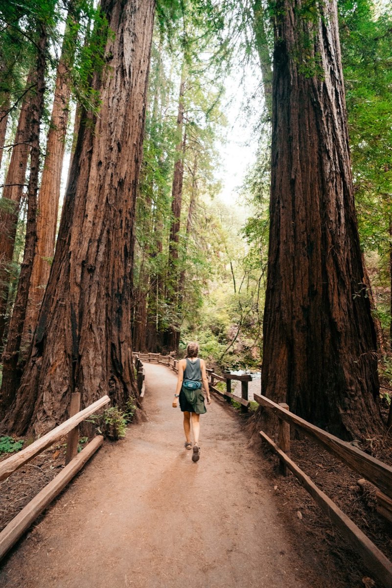
Muir Woods National Monument is the closest old-growth coast redwood forest to San Francisco - a 554-acre grove of Sequoia sempervirens in a narrow canyon whose cool, fog-sheltered conditions have allowed trees to reach 250 feet and 1,000+ years of age. It’s 17 miles from the city but requires either a parking reservation (approximately $10 as of 2026, book at gomuirwoods.com) or the seasonal shuttle from Sausalito.
Entry to Muir Woods is approximately $15 per adult as of 2026, required for all visitors. The main Cathedral Grove trail (1 mile round-trip, flat) walks through the densest concentration of old-growth trees; the full Muir Woods loop (4 miles) adds hillside forest. The combination of canyon shade and coastal fog means temperatures inside the grove are typically 10–15°F cooler than the surrounding hillsides - bring a layer regardless of season.
Mount Tamalpais State Park surrounds the monument and extends to the 2,571-foot summit of Mount Tam - the ridgeline above Muir Woods offers views across the Bay Area, south to San Francisco, and north to Point Reyes on clear days. The Dipsea Trail (7.1 miles from Mill Valley to Stinson Beach) is one of the most celebrated trail runs in California, descending through the redwoods before dropping to the coast; it’s negotiable on foot but strenuous.
Stinson Beach (free) at the base of Mount Tam is one of the few swimmable ocean beaches in the Bay Area (lifeguards in summer, water temperatures peak around 60°F in August). The village has several good cafes; Parkside Café is reliable for breakfast and lunch.
Point Reyes National Seashore - 1 hour 15 minutes north via Sir Francis Drake Blvd
Point Reyes is a 71,000-acre peninsula separated from the mainland by the San Andreas Fault - the peninsula has moved 25 feet northwest relative to the mainland over geological time, and the 1906 earthquake shifted it 20 feet in 45 seconds. The Earthquake Trail at Bear Valley (free, 0.6 miles) shows the offset fence line from 1906 in the field.
The Point Reyes Lighthouse (free entry, open Thursday–Monday typically, verify at nps.gov/pore) sits at the southwestern tip of the peninsula, 300 steps below the parking lot - the most exposed point in the National Seashore with frequent 30+ mph winds. Gray whale migration passes the lighthouse January through April; elephant seal haul-outs at Chimney Rock are visible December through March.
The Bear Valley Trail (8.2 miles round-trip from the visitor center) crosses the ridge through Douglas fir and coastal scrub to Arch Rock on the ocean bluff - a full day’s hiking. Shorter options from Bear Valley include the Sky Trail and the Woodpecker Trail loop (2.8 miles).
Tomales Bay (the long bay running north from Point Reyes Station on the fault line) has two active oyster farms open to the public - Hog Island Oyster Co. and Point Reyes Oyster Company both offer picnic tables and self-serve oysters (approximately $20–$30/dozen as of 2026). This requires a reservation; both book out weeks in advance on weekends.
The town of Point Reyes Station (at the base of the peninsula) has the excellent Cowgirl Creamery (cheeses, from approximately $10 per piece) and Osteria Stellina (Italian, lunch mains approximately $18–$30).
Santa Cruz - 1 hour 15 minutes south via CA-17 or CA-1
Santa Cruz sits at the northern end of Monterey Bay, historically a beach resort town and surf capital that now also encompasses the University of California Santa Cruz campus on the hill above the city. It’s one of the more easily accessible day trips without a car.
Search hotels in San Francisco on Booking.com
The Santa Cruz Beach Boardwalk (free park entry; ride tickets approximately $4–$6 each, or all-day pass approximately $55 as of 2026) is the last remaining major seaside amusement park on the West Coast - the Giant Dipper wooden roller coaster (1924) and Looff Carousel (1911) are both National Historic Landmarks still in operation. The beach adjacent to the Boardwalk is a wide sandy strand with summer lifeguards.
Natural Bridges State Beach (day use fee approximately $10 as of 2026) at the west end of the city has a natural arch visible from the beach and a Monarch butterfly overwintering grove (October–February) that shelters thousands of butterflies in the eucalyptus trees behind the beach.
The UC Santa Cruz campus (free to walk through) occupies 2,000 acres of redwood forest above the city - redwood groves thread between the concrete brutalist buildings in a combination that doesn’t work on paper but does in practice. Cowell Lime Works Historic District on campus preserves the industrial remnants of the original ranch.
The West Cliff Drive coastal path runs 2.5 miles along the blufftops west of the Boardwalk - surfing at Steamer Lane below (a major competitive surf break) is visible from above. The nearby Surf Museum (entry approximately $5 as of 2026) is one of the best of its type in the country.
Monterey and Carmel - 2 hours south via US-101 or CA-1
Monterey and Carmel sit 4 miles apart at the south end of Monterey Bay - different in character but easily combined in a single day. Monterey is a working harbor city with the state’s best aquarium; Carmel-by-the-Sea is a village of 3,700 people with no street addresses, no parking meters, and the densest concentration of art galleries per capita in California.
The Monterey Bay Aquarium (entry approximately $50 as of 2026) is the standard against which other American aquariums are measured - the Giant Pacific Octopus exhibit, three-story kelp forest tank, open-sea pelagic exhibit, and the quality of the interpretive material throughout. Book tickets in advance; summer weekends sell out.
Cannery Row (free to walk) documents the sardine processing industry that collapsed in 1950 when sardine stocks were depleted - Steinbeck’s Cannery Row gave the street its literary character, and several of the original buildings remain. The street itself is now primarily restaurants and hotels, but the converted industrial architecture is visible.
Carmel-by-the-Sea has no chain restaurants or chain hotels permitted by city ordinance, and no building can be taller than the tree line. The result is a genuinely distinctive village. The Carmel Mission (entry approximately $10 as of 2026) is one of the most beautifully restored of California’s missions, with a Moorish fountain in the courtyard and the grave of Fr. Junípero Serra. Carmel Beach at the base of Ocean Avenue is one of the finest white-sand beaches in California.
17-Mile Drive through Pebble Beach (toll approximately $12.50 as of 2026) circles the Monterey Peninsula through pine forest and past Lone Cypress on its granite headland - a short drive worth doing if you’re between Monterey and Carmel.
Yosemite Valley - 3 hours 30 minutes east via CA-120 (summer) or CA-140 (year-round)
Yosemite Valley is the reason Northern California exists in the imagination of most people outside California - 7 miles of glacier-carved granite valley with 3,000-foot walls, five waterfalls visible from the valley floor, and a floor covered in meadows and black oak woodland.
Entry is approximately $35/vehicle as of 2026. From April through October, timed entry reservations are required to enter the park by car (available at recreation.gov, 90 days in advance) - day visitors without reservations are turned away at the gate. This is not a hypothetical enforcement; the park actively manages vehicle numbers.
Yosemite Falls (2,425 feet total drop, the tallest in North America) is visible from the Valley floor at its most powerful in May and early June; it often reduces to a trickle by late summer. The trail to the top (7.2 miles round-trip, gaining 2,700 feet) is one of the park’s most rewarding but requires a full day.
Half Dome is the Valley’s signature granite formation - the cable route to the summit (17 miles round-trip, 4,800 feet gain) requires a separate lottery-based permit; day-hikers without permits can still reach Sub Dome via the Half Dome Trail. El Capitan (3,000 feet of granite) is best viewed from the meadow on the valley floor - the best position for watching climbers on the big wall routes.
Mariposa Grove at the park’s south entrance (accessible by shuttle from Wawona) has 500 mature Giant Sequoias, including the Grizzly Giant (1,900+ years old, 96 feet in circumference at the base). For a day trip from San Francisco, prioritizing Valley floor views, Yosemite Falls Trail, and Mirror Lake is more realistic than attempting Mariposa Grove as well.
Book Yosemite and Bay Area tours
Lake Tahoe - 3 hours 30 minutes northeast via I-80 or US-50
Lake Tahoe sits at 6,225 feet in the Sierra Nevada on the California-Nevada border - 22 miles long, 12 miles wide, and 1,645 feet deep, with water clarity exceptional enough that you can see objects 70 feet below the surface. The surrounding national forest has more than 300 miles of trails accessible without any park entry fee.
The north and south shores have different characters: South Lake Tahoe (closer via US-50) has casino hotels and a larger year-round population; North Tahoe (Tahoe City, Kings Beach) is smaller and less commercial, with more direct access to the Tahoe National Forest hiking areas.
Emerald Bay State Park (day use fee approximately $10 as of 2026) is the most photographed location in California - a small bay with an island at its center, Scandinavian-style mansion ruins (Vikingsholm, free tours in summer), and views down the full length of the lake. The bay is inaccessible by boat in summer due to overuse protections; the viewpoint parking lot fills by 9am on weekends.
Sand Harbor State Park on the Nevada side (day use fee approximately $12 as of 2026) has some of the lake’s clearest water and a boulder-strewn beach that’s excellent for swimming. The Lake Tahoe Shakespeare Festival uses an outdoor amphitheater here in summer (tickets approximately $50–$100 as of 2026).
Heavenly Mountain Resort operates gondola rides year-round from the South Lake Tahoe village (approximately $45 as of 2026) - the top station at 9,123 feet has views into Nevada and down to the lake. In winter, Heavenly is the largest ski resort in California and Nevada with 97 trails.
For food in South Lake Tahoe, Sprouts Natural Foods Café (bowls and smoothies, approximately $12–$18) and Basecamp Hotel restaurant are reliable options; the north shore has good dining in Tahoe City at Wolfdale’s (California cuisine, dinner mains approximately $30–$45).
Book Lake Tahoe and Bay Area tours