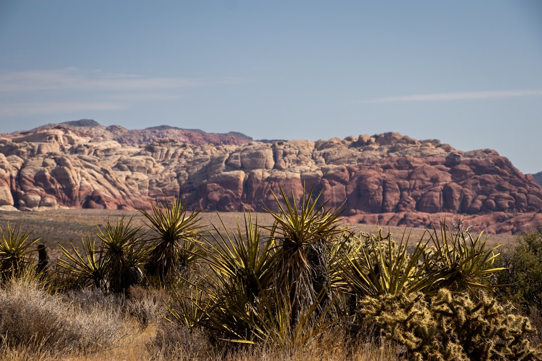
Las Vegas sits at the centre of one of the most dramatic natural landscapes in North America. Within 30 minutes you can be inside red sandstone canyons; within an hour, walking among 3,000-year-old petroglyphs. Within 2.5 hours, Zion Canyon’s 2,000-foot walls close in around you. The city is surrounded by five states’ worth of extreme desert, mountain, and canyon terrain - more accessible from a single base than almost anywhere else in the country.
For the city itself, see our Las Vegas guide and Things To Do In Las Vegas.
Red Rock Canyon (17 miles, ~25–30 min via W Charleston Blvd)
Red Rock Canyon National Conservation Area (1000 Scenic Loop Dr; approximately $15 per vehicle as of 2026) is the closest dramatic landscape to the Strip. The 13-mile Scenic Loop is one-way and covers the main formations - it can be driven in 45 minutes, but the hiking trails are the reason to visit.
Calico Hills (accessible from Parking Area 1) is a formation of red and cream Aztec Sandstone with short scrambles across smooth rock and sweeping views back toward the city skyline. Pine Creek Canyon (3-mile loop; moderate) winds into a sheltered wash with a seasonal stream and the ruins of a 1920s homestead - one of the more rewarding hikes in the area. The Lost Creek-Children’s Discovery Trail (1.5 miles; easy) is the best introduction for families or first-time visitors.
Climbing is the serious pursuit at Red Rock. It is one of the top sport and traditional climbing destinations in North America, with routes from beginner slabs to multi-pitch 2,000-foot big walls on sandstone like Calico Hills and Rainbow Wall. Calico Basin (free, outside the fee area) has more accessible bouldering if you want to try the rock without committing to the loop fee.
The entry system on peak days pauses vehicle access when the road fills - arrive before 8:30am on weekends or you may queue outside. Spring (March–May) and autumn (September–November) are the best seasons. Summer mornings before 8am are manageable; summer afternoons are punishing.
Hoover Dam (35 miles, ~40–45 min via US-93 S)
Hoover Dam (Boulder City, NV) is one of the great engineering landmarks of the 20th century - completed in 1936, it was the largest concrete structure in the world at the time of construction. It impounds Lake Mead, supplies water to 40 million people across seven states, and generates enough electricity to power 1.3 million homes.
Parking costs approximately $10. The Dam Tour (approximately $30 as of 2026) walks through the interior penstock tunnels to the power plant and generator hall - the turbines are the size of houses. The Powerplant Tour (approximately $15 as of 2026) is a shorter version covering the turbine hall only. Both are worth it; the generator floor is the most impressive single space.
Boulder City (7 miles from the dam) was purpose-built to house dam construction workers and is notably the only Nevada city that banned gambling during construction - it remained without a casino for decades. The Boulder City/Hoover Dam Museum (444 Hotel Plaza; approximately $8 as of 2026) covers the dam’s history and the lives of the 21,000 workers involved in building it.
Search hotels in Las Vegas on Booking.com
Lake Mead National Recreation Area (approximately $20 per vehicle as of 2026) wraps around the reservoir behind the dam. It is the largest reservoir in the US by volume when full - in recent drought years the water level has dropped dramatically, exposing the famous “bathtub ring” of mineral deposits on the canyon walls. Hemenway Harbor has boat rentals if you want to get on the water.
Valley of Fire State Park (60 miles, ~1 hour via I-15 N and NV-169)
Valley of Fire State Park (Valley of Fire Rd, Overton; approximately $15 per vehicle as of 2026) is Nevada’s oldest and largest state park - 40,000 acres of Aztec sandstone in shades of orange, red, white, and purple, formed from ancient sand dunes compressed and uplifted over millions of years.
The Fire Wave trail (1.5 miles round-trip; moderate) is the most photographed formation - eroded sandstone striated in red and white that genuinely resembles a frozen ocean wave. Elephant Rock (short trail near the east entrance) is the accessible and immediately impressive landmark visible from the car park. Rainbow Vista overlooks a wide valley of multi-coloured formations.
Atlatl Rock (interpretive trail near the visitor centre) has a metal staircase leading to a large panel of Ancestral Puebloan petroglyphs - some of the most accessible ancient rock art in Nevada, dating back approximately 3,000 years. White Domes Trail (1.25 miles loop; moderate) passes through a narrow slot canyon and past a former 1960s film set used in several Westerns.
Timing is critical: Valley of Fire overheats by 10am from May through September. Visit before 8am or after 4pm in summer. October through April is ideal - the iron oxide in the sandstone reads more intensely in low-angle morning and evening light.
Zion National Park, Utah (160 miles, ~2.5 hours via I-15 N)
Zion Canyon is a 2,000-foot-deep sandstone slot cut over millennia by the Virgin River. The park receives more than four million visitors per year and requires planning: the shuttle system is mandatory from March through November - cars park at the visitor centre, and free park shuttles serve all major trailheads in the canyon.
The Narrows (bottom-up approach; no permit required for this direction) is the defining Zion experience - following the Virgin River through a slot canyon that narrows to 20–30 feet wide. The entry point is the Temple of Sinawava shuttle stop. The paved Riverside Walk (2.2 miles round-trip; easy) serves as the warm-up; wading into The Narrows proper begins just beyond. Waterproof sandals or neoprene socks are strongly recommended - rental waterproof boots are available from Zion Outfitter (95 Zion Park Blvd, Springdale; approximately $20–25 as of 2026).
Angels Landing requires a permit via seasonal lottery on recreation.gov (approximately $6 as of 2026). The final half-mile of the 5.4-mile round-trip uses chains bolted to the rock face to assist the ascent - the exposure is genuine, not theatrical. The views from the top are extraordinary.
Emerald Pools Trail (lower loop, 1.8 miles; moderate) leads to a waterfall and pool fed by seeps in the sandstone wall - an easier objective than Angels Landing and almost as scenic.
Park entry is approximately $35 per vehicle for a 7-day pass as of 2026. Arrive before 8am on any summer weekend or the visitor centre car parks fill and entry is queued.
Death Valley National Park, California (120 miles, ~2 hours via I-15 N and NV-160)
Death Valley is the hottest, driest, and lowest national park in North America. The main hub is Furnace Creek (visitor centre, cafeteria, and the historic The Inn at Death Valley). Entry is approximately $35 per vehicle for a 7-day pass as of 2026.
Badwater Basin (17 miles south of Furnace Creek) is the floor of the valley at 282 feet below sea level - the lowest point in North America. A white salt flat stretches to the horizon; mountains rise 11,000 feet directly above it. Walk out across the salt crust for the view - no trail required.
Zabriskie Point (4 miles east of Furnace Creek) overlooks a surreal badland of golden and brown eroded mudstone ridges. The late afternoon light is exceptional - this is the classic Death Valley viewpoint.
Mesquite Flat Sand Dunes (19 miles north of Furnace Creek) are the most accessible dune field in the park - no trail, just walk in from the roadside car park. The dunes rise to around 100 feet and photograph well in early morning with raking light.
Artist’s Palette (9-mile Artist’s Drive loop; one-way) passes a hillside of oxidised volcanic deposits in pinks, purples, reds, and greens - one of the most otherworldly landscapes in the American West.
CRITICAL: Only visit October through April. June through August temperatures regularly exceed 120°F (49°C) and have been recorded above 130°F. Multiple visitors die in Death Valley each summer from heat-related causes. The park service is not exaggerating when they say stay in your car in summer.
Bryce Canyon National Park, Utah (270 miles, ~3 hours via I-15 N and UT-12)
Bryce Canyon is technically an amphitheatre rather than a canyon - a series of natural bowls eroded into the edge of the Paunsaugunt Plateau in southern Utah, exposing thousands of hoodoos: tall, thin spires of soft limestone in shades of orange, white, and red.
Navajo Loop Trail (1.3 miles; strenuous; steep switchbacks) descends into the canyon for the classic ground-level hoodoo experience, passing through Wall Street - a narrow corridor between 100-foot rock fins - and under Thor’s Hammer, the most photographed hoodoo formation in the park. The trail connects to the Queen’s Garden Trail (1.8 miles; moderate) for a longer 3-mile loop.
Sunrise Point and Sunset Point (both accessible by short walks from Bryce Canyon City or the free park shuttle) are the best rim overlooks - Sunrise Point at dawn and Sunset Point in golden hour live up to their names.
Park entry is approximately $35 per vehicle for a 7-day pass as of 2026. At 8,000+ feet elevation, Bryce is significantly cooler than Las Vegas - bring a layer even in summer. The park is accessible year-round; in winter, the orange hoodoos against white snow is one of the most striking landscapes in the Southwest.
Bryce pairs well with Zion on a multi-day Southern Utah road trip. For a single day trip from Las Vegas, Zion is closer (2.5 hours vs. 3 hours) but Bryce’s hoodoos are unique enough to justify the extra 30 minutes.
Grand Canyon South Rim, Arizona (270 miles, ~4.5 hours via US-93 S and I-40 E)
The South Rim is a long day trip from Las Vegas - 4.5 hours each way - but it is doable as a very early start. Most organised tours depart Las Vegas at 5–6am. Many visitors reasonably choose to make it an overnight trip, which allows a sunrise and sunset on the rim.
Mather Point (immediately inside the south entrance) is the first and most dramatic overlook - the Grand Canyon presents itself immediately and at scale: one mile deep, 10 miles across, 277 miles long. The Rim Trail (13 miles; mostly flat; paved in the main section) runs along the canyon edge between overlooks and is the best way to see multiple viewpoints without driving between car parks.
Bright Angel Trail descends from the South Rim Village - the 1.5-Mile Resthouse (3 miles round-trip; 1,100 feet of descent) is achievable in a day trip with solid footwear and ample water. Do NOT attempt to reach the Colorado River and hike back in a single day in summer - rangers post explicit warnings at the trailhead for good reason.
Desert View Watchtower (25 miles east of Mather Point on Desert View Drive; free) is a 1932 stone tower designed by Mary Colter with panoramic views and Hopi artwork in the interior. Worth the drive if time allows.
Entry is approximately $35 per vehicle for a 7-day pass as of 2026. The America the Beautiful Annual Pass (approximately $80 as of 2026) covers all NPS sites and pays for itself in two to three Grand Canyon-calibre visits - useful if you are also visiting Zion, Bryce, or Death Valley.
Guided tours from Las Vegas via GetYourGuide handle the 4.5-hour drive and often include Hoover Dam on the same route - particularly useful if you prefer not to drive it yourself.
Lake Havasu City, Arizona (150 miles, ~2 hours via US-93 S)
Lake Havasu City is the destination for a different kind of day trip - water sports and the genuine curiosity of the London Bridge, relocated here from England in 1971. The bridge was sold by the City of London to developer Robert McCulloch for approximately $2.46 million and transported stone by stone to the Arizona desert, where it now spans a channel of the Colorado River.
The bridge is free to walk across and the English Village below it has shops and restaurants. The real draw for most visitors is the lake itself: the Colorado River widens into Lake Havasu, which offers swimming, jet skiing, paddleboarding, and kayaking. Several operators on the waterfront rent equipment for approximately $60–120 per hour as of 2026.
Cattail Cove State Park (approximately 15 miles south of town; approximately $15 per vehicle as of 2026) has a sandy beach and calmer water away from the main marina traffic. Windsor Beach (near the English Village) is the most convenient swim spot.
Lake Havasu City is worth a half-day or a full day if you want to be on water. The drive down US-93 through the Mojave passes through the Black Mountains and has some of the most dramatic desert mountain scenery on the route south from Vegas.
Practical Tips
- Red Rock Canyon timed entry pauses access on peak days - arrive before 8:30am on weekends
- Valley of Fire in summer is genuinely dangerous in midday heat - carry at least one litre of water per hour of hiking
- Zion shuttle queues add 30–45 minutes on summer weekends - factor it into your timeline
- Death Valley is for October–April only; this is not an advisory, it is a safety rule
- Grand Canyon requires a 5am departure minimum for a day trip from Las Vegas
- The America the Beautiful Annual Pass (approximately $80 as of 2026) covers entry to all NPS sites and pays for itself quickly if you hit Zion, Bryce, Death Valley, and Grand Canyon in one trip
- Prices as of 2026 - confirm at nps.gov, recreation.gov, and individual site pages before travelling
For guided day trips, GetYourGuide’s Las Vegas selection covers Grand Canyon, Red Rock, Valley of Fire, and Hoover Dam with knowledgeable guides and smaller vehicles. A rental car gives the flexibility needed for Death Valley, Lake Havasu, and multi-stop days.